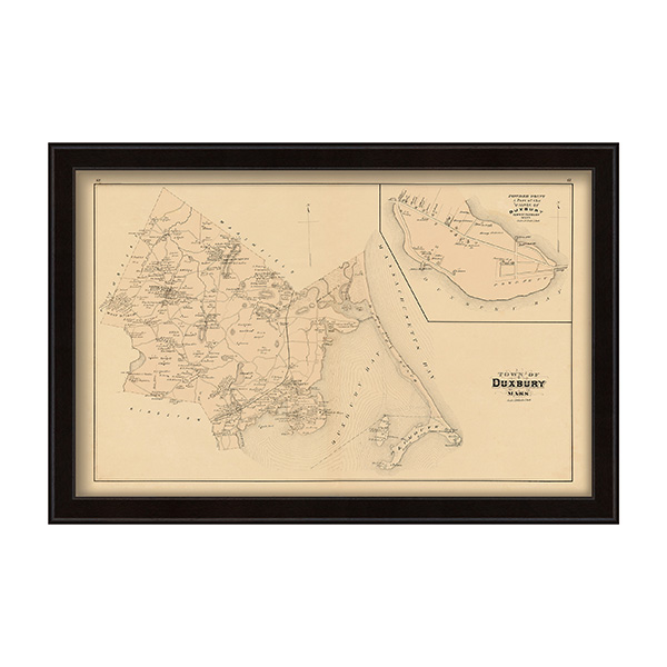
DUXBURY, Massachusetts 1879 Map Framed Print
$ 97.43
Free shipping on orders over £50
- Satisfaction Guaranteed
- No Hassle Refunds
A Reproduction of a colored map of the Town of DUXBURY, Massachusetts from the 1879 Atlas of Plymouth County, Massachusetts published by Geo. H. Walker & Co. Boston, 61 Hanover St. Boston Mass. Dimensions of the original Map are: 18″ by 28″ .
Related products
-
-
-
CAPE COD BAY, MA – 2013 Nautical Chart Framed Print
$ 97.43Select options This product has multiple variants. The options may be chosen on the product page -